
Palouse to Cascades Trail Overnighter

Route: Palouse to Cascades State Park Trail West
Ride Type: Bikepacking Overnighter
Ride Surface: Packed Gravel
Difficulty: Moderate
With many great State Parks and trails to choose from, Washington State is a great place to get outside and enjoy all that nature has to offer. So when a couple of buddies and I wanted to do some gravel riding, we immediately thought of the Palouse to Cascades trail. Formerly called the Iron Horse Trail, this trail system spans 285 miles of the state starting in the lush greens forests of the cascade mountains and ending in the desert landscape of Eastern Washington. The trail follows the historic old railway passage known as the Milwaukee Road Corridor. Built in the early 1900’s it was touted as the best-engineered railway in the Pacific Northwest. The line was used for many decades until the railroad company went bankrupt in 1977. In 1980, the State Of Washington purchased the Milwaukee Road Corridor and slowly began repurposing it into a gravel trail for bikers, hikers and horseback riders.
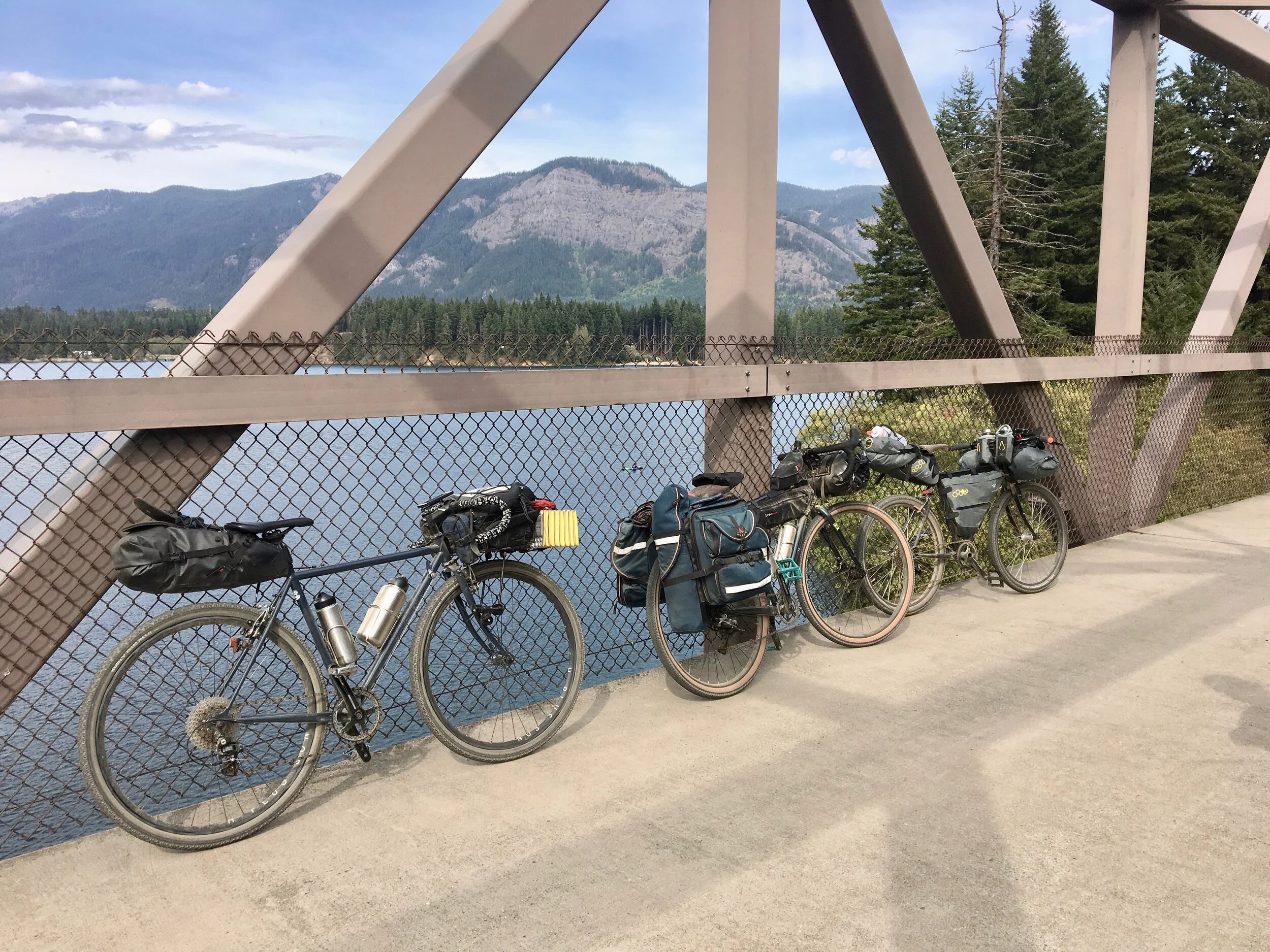
I’ve been wanting to ride the length of this historic route for a long time. With time constraints though, we opted for an overnighter on the western part of the trail. Our route was pretty simple, we would start at the trailhead near Rattlesnake lake, pedal up through the pass [via the awesome Snoqualmie Tunnel], camp at Lake Easton State Park, and then head back the way we came. About an 80-mile journey in total.

Day One: Rattlesnake Lake Recreation Area to Lake Easton State Park
Distance: 40 miles
Route Details: MAP
We started the day rather early as we had about an hour's drive to the trailhead. Once we offloaded our bikes and gear from the car we headed off. It didn’t take long to see just how beautiful this trail is. Hugging the ridgeline through the mountains, the trail traverses over many creeks and ravines with stunning views of the valley floor below.


Although this trail is quite secluded from any form of modern life, I was surprised to find out how busy this trail is in the summer. Along the way, we passed cyclists, rock climbers, runners, and hikers. We even rode through a marathon that was happening the same weekend.


After the gradual slow climb to the pass, we excitedly arrived at the Snoqualmie tunnel. Completed in 1914, it spans just over two miles making it the longest trail tunnel in the country. We psyched ourselves up, turned on our lights and put on our jackets as there was a vortex of cold air rushing out the entrance towards us. The ride through the tunnel was eerie as our headlights were barely able to make a dent in the darkness all around us. The damp dark environment daring to transport us to another place, underneath the earth, where time seems to lose its grasp. Then, after what seemed like an eternity, we finally emerged on the other side at Hyak.
We stopped there for lunch and took the opportunity to fill up our water bottles, which ended up being the only water fill up we found along the trail. [Although this is the only water fill up, if you have a water purification system there is no shortage of streams and rivers along the trail to top off at if needed]


After filling our bellies, we headed off for the final push to camp. This section of the trail hugs the westernmost shore of Keechelus Lake. This is a beautiful section of trail with stunning views all around.

Meandering onward with the Yakima river, we eventually arrived at Lake Easton State Park. Although the park has hiker/biker spots, because of our group size we decided to get a standard campsite which we booked ahead of time online. We ended our day with some delicious street-style tacos and a few rounds of bocce ball.


Day Two: Lake Easton State Park to Rattlesnake Lake Recreation Area
Distance: 38 Miles
Route Details: MAP
After a very wet and soggy night, [our tents certainly were tested but we surprisingly all stayed dry] we had breakfast and got pedaling. The trail conditions from the Easton to Hyak weren’t too different from the day before, but once we got through the tunnel things changed drastically. What was dust the day before turned to mud as we began our descent back down to Rattlesnake lake. We were all a little caught off guard on just how much elevation we had gained the day before and found ourselves flying down the trail with mud on our backs and smiles on our faces. We made great time, shaving off almost two hours from our ride the day before.

This was a great trip and I would do it again in a heartbeat. I would like to traverse the entire route once Beverly Bridge over the Columbia River gets renovated. As of right now, [2019] the trail is cut into two sections; PTCT East and PTCT West as their’s no easy way to get over the Columbia by bike currently.
If you’re thinking of riding the trail, a great resource is the PTCT Coalition website. This will give you great maps, history, and info to make your ride fun and enjoyable. Happy Trails!